Sunday 21 June 2026 20:59 |
41
antique dealers present:
228,404
antiques with photo.
4
conservator,
2
antique fairs,
2
associations.
Old Treasures - New Technology
Advanced search
here
.
Search for:
Exhibitors
Items
Latest items
Associations
Frontpage
Mobile version
The notice board
Tools
News letter
Calendar
Mobile version
Bookmark this page
Use as startpage
About WorldAntique.Net
Want to exhibit here ?
Watch video presentation
Contact
Why X marks?
Guaranteed Reduced
Denmark
Deutschland
Global
Portal categories
>>
Books, postcards, maps
>>
Maps
Advanced search
here
.
Pegasus Kunst - Antik - Design
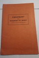
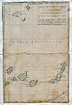
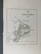
Pontoppidan's Danish Atlas, 1769, map of Aabenraa.
Pegasus Kunst - Antik - Design
Mejer, Johannes (1606 - 1676) Denmark: Map of the northern part of the Duchy ...
Pegasus Kunst - Antik - Design
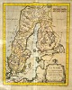
Van den Keere, Pieter (1571 – c. 1646) Holland: Map of Southern Sweden.
Pegasus Kunst - Antik - Design
Nicolas de Fèr (1646 - 1720) France: General map of Denmark. .
Pegasus Kunst - Antik - Design
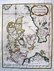
Willem Janszoon Blau (1571 - 1638) Netherlands: General map of Denmark. 1634.
Pegasus Kunst - Antik - Design
Alexis Hubert Jaillot (1632 - 1712) France: General Map "Le Royaume de ...
Pegasus Kunst - Antik - Design
Mercator, Gerardus (1512 - 1594) Germany/Flanders: Special map of Central ...
Pegasus Kunst - Antik - Design
Frederik de Witt (17th century) Netherlands: Special map of the dioceses of ...
Pegasus Kunst - Antik - Design
Johann Baptist Homann (1663 - 1724) Germany: General map of Denmark. 1714.
Aabenraa Antikvitetshandel
Map showing the Kingdom of Denmark by Ortelius 1854. Size with frame: 51x59cm
Aabenraa Antikvitetshandel
Map showing the Kingdom of Denmark by Ortelius 1854. Size with frame: 50x64cm
ViKaLi
Landkort Tønder (Map of the town, Tonder, Denmark)
"Der Amt Tondern ohne ...
ViKaLi
Bilder - Artlas 8
Geographie
56 Tavler og 28 Kort
Photographische ...
ViKaLi
Album von Berlin
3 Grosse Panoramen und 49 Ansichten nach Momentaufnahmen ...
ViKaLi
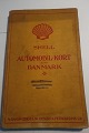
Shell
Automobil-Kort
Danmark
Med foto af Shell-Huset før bombningen blev ...
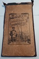
ViKaLi
Autokort
A/S Dansk Shell
Danmark
Udgivet af Dansk Shell A/S
In a good ...
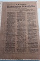
ViKaLi
Schul-Atlas
A. Scobel
Verlag von Velhagen und Klasing
1905
Løse blade
ViKaLi
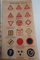
Deutsche Strassenprofilkarte für Rad- und ...
ViKaLi
Antiche Karte des Gaues Schleswig Holstein des Deutschen Radfahrer ...
ViKaLi
Turistkort for Silkeborg og omegn
Udgivet af Silkeborg Turistforening
In a ...
ViKaLi
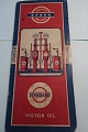
Standard Motor Oil Pratt Benzin Landkort (Big map)
Øerne og Jylland
Stort ...
ViKaLi
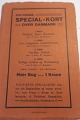
Politikens specialkort over Danmark - København
Gammelt kort
In a good ...
ViKaLi
Landkort over Als (An old map of the island Als, Denmark)
Gammelt landkort ...
ViKaLi
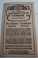
Gyldendals Amtskort over Danmark (Map over part of Denmark)
Lolland-Falster ...
ViKaLi
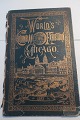
World´s Columbian Exhibition, Chicago
1492 - 1893 - 1892
Very used - loose ...
ViKaLi
Sønderborg Byhistorisk Atlas
Udgivet af Museet på Sønderborg Slot
1982
In ...
ViKaLi
Kort og prospekter fra byer i Sønderjylland
Th. Laursens Bogtrykkeri A-S - ...
Pegasus Kunst - Antik - Design
Homann, Johann Baptist (1663 - 1724) Germany: Map of Scandinavia.
Pegasus Kunst - Antik - Design
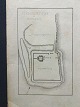
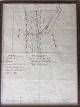
Skeleton Map of Horsens and Surroundings, 1823.
Pegasus Kunst - Antik - Design
Janssonius, Jan (17th century). Special map of Funen. Atlas Novus, 1647.
Pegasus Kunst - Antik - Design
Prospect of Varde, 1767.
Pegasus Kunst - Antik - Design
Map of Sweden. 1762. France.
Pegasus Kunst - Antik - Design
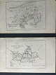
Chart of the Belts and Sound 1808, Denmark.
Pegasus Kunst - Antik - Design
Danish artist (18th century): Map of Northwest Zealand. 1771.
Pegasus Kunst - Antik - Design
Mercator, Gerardus (1512 - 1594) Germany / Flanders: Map of Holstein.
Aabenraa Antikvitetshandel
J. & W. Blaeu "Germaniae Veteris Typus" published circa 1645. Size: 38x48cm
Pegasus Kunst - Antik - Design
Hand-colored map of the Ejderstedt area in northern Germany. 1648
Pegasus Kunst - Antik - Design
Hand-colored map of Denmark. Copper plate. T. Kitchin, London ca. 1755. ...
Pegasus Kunst - Antik - Design
Prospectus for Helsingør and Ribe. Cupperplate, 1600s.
Pegasus Kunst - Antik - Design
Insular Danicæ in Mari Balthico. 1714
Pegasus Kunst - Antik - Design
Map of Zealand, 1764. Hand-colored copper engraving
Pegasus Kunst - Antik - Design
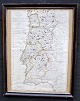
Map of Portugal. 1822
Pegasus Kunst - Antik - Design
Map of Ærø and Femarn, 1766.
Pegasus Kunst - Antik - Design
Dahlberg, Erik Jönsson (1625 - 1703) Sweden: Map of Korsør, Denmark. Plate ...
Pegasus Kunst - Antik - Design
Prospect, Grenå, 1767.
Pegasus Kunst - Antik - Design
Hand-colored map of the island of Gorèe, 19th century
Pegasus Kunst - Antik - Design
Map of the Canary Islands, 19th century, French edition
Pegasus Kunst - Antik - Design
Map of Copenhagen County 1766
Pegasus Kunst - Antik - Design
Map of Europe in ancient times. 17th century
Pegasus Kunst - Antik - Design
Map of Rome at Servius Tullius time, 18th century
Pegasus Kunst - Antik - Design
Dahlberg, Erik Jönsson (1625 - 1703) Sweden: Map of the entrance to the ...
Pegasus Kunst - Antik - Design
Haas, Jonas (1720 - 1775) Denmark. Map of Aarhus Stift.
Pegasus Kunst - Antik - Design
Haas, Jonas (1720 - 1775) Denmark. Postcard over Roskilde. Original copper ...
Pegasus Kunst - Antik - Design
Map of Paris, 19th century.
Pegasus Kunst - Antik - Design
Jens Nicolas Bellin (18th cent. ) France . : Denmark map.
Pegasus Kunst - Antik - Design
Map, 17th century. Cologne archdiocese.
Pegasus Kunst - Antik - Design
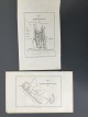
Engraving, 1596, topographical surveys of Heide and Meldorf, Holstein.
Pegasus Kunst - Antik - Design
Dahlberg, Erik Jönsson (1625 - 1703) Sweden: Map of Korsor.
Pegasus Kunst - Antik - Design
The city Haderslev. Engraving 1780
Pegasus Kunst - Antik - Design
Dahlberg, Erik Jönsson (1625-1703) Sweden. Map of Nyborg
Pegasus Kunst - Antik - Design
Hand colored map of England, French version, 1709.
Pegasus Kunst - Antik - Design
Map, 17th century. Hungary. Johan Baptista Homanno
Pegasus Kunst - Antik - Design
Carte du Danne Marc, designed by Jean Nicalas Belis, 1764.
Pegasus Kunst - Antik - Design
Hand colored maps of Saxony, Germany, 1637
Pegasus Kunst - Antik - Design
Prospect of Skanderborg Castle and Towne. 1767. Denmark.
Pegasus Kunst - Antik - Design
Map of the diocese of Evreux, northern Normandy, France.
In other languages:
Ole Buus Larsen
Kobberstik af Erik Pontoppidan og Jonas Haas - Aalborg 1768 - fra Danske Atlas.
Ole Buus Larsen
Gammelt kobberstik af Erik Pontoppidan og Johan Georg Schmid - Aalborg By ...
Ole Buus Larsen
2 Kort over Nykøbing Sjælland købstad 1859.
Ole Buus Larsen
Litografi af Em. Bærentzen - Grundtegning af Kalø Slotsplads.
Kinnerup Antik & Porcelæn
L. Both tryk
Aalborg Amt år 1871
Kinnerup Antik & Porcelæn
Prospekt over Aalborg
af D. C. Fester
Ole Buus Larsen
Kort over Frederikssund Kjøbstad 1859.
Ole Buus Larsen
2 Kort over Mariager Kjøbstad 1858.
Ole Buus Larsen
2 Kort over Nibe Kjøbstad 1859.
Ole Buus Larsen
2 Kort over Ringkjøbing Kjøbstad 1858.
Ole Buus Larsen
Militært Kort over Tønning i Sydslesvig ca. 1700 af Gabriel Bodenehr.
ViKaLi
Grundrids og prospekt over Tranquebar
Af Matthæus Seutter, 1756, - Kortet ...
Ole Buus Larsen
Gammelt kobberstik af Erik Pontoppidan - Kort over Nykøbing Falster - fra ...
Ole Buus Larsen
Gammelt koloreret kobberstik af Erik Pontoppidan - Kort over Nakskov - fra ...
Ole Buus Larsen
Fransk kort over Hansestæderne ca 1860.
Ole Buus Larsen
Litografi - Maribo købstad 1859.
Ole Buus Larsen
Håndkoloreret litografi - Maribo købstad 1859.
Ole Buus Larsen
Koloreret kort over Engestofte på Lolland ca 1860.
Ole Buus Larsen
Gammelt kobberstik af Erik Pontoppidan - Kort over Ebeltoft - fra Danske ...
Ole Buus Larsen
Gammelt kobberstik af Erik Pontoppidan - Kort over Faaborg - fra Danske ...
Ole Buus Larsen
Litografi - Kort over Fredericia by efter Peder Hansen Resens kobberstik 1677.
Ole Buus Larsen
Kort over Nykjøbing Kjøbstad paa Mors 1860.
Ole Buus Larsen
Kort over Store Hedinge Kjøbstads Jorder 1860.
Ole Buus Larsen
Kort over Rødby Kjøbstad 1860.
Ole Buus Larsen
Gammelt koloreret kobberstik af Erik Pontoppidan - Kort over Sakskøbing - ...
Ole Buus Larsen
Gammelt koloreret kobberstik af Erik Pontoppidan - Kort over Stubbekøbing - ...
Ole Buus Larsen
Gammelt, håndkoloreret kobberstik af Erik Pontoppidan - Kort over Rødby - ...
Ole Buus Larsen
Gammelt kobberstik af Erik Pontoppidan - Kort over Præstø - fra Danske Atlas ...
Ole Buus Larsen
Gammelt kobberstik af Erik Pontoppidan - Kort over Sakskøbing - fra Danske ...
Ole Buus Larsen
Litografi - Kort over Nakskov by efter Peder Hansen Resens kobberstik 1677.
Ole Buus Larsen
Litografi - Kort over Nykøbing Falster by efter Peder Hansen Resens ...
Ole Buus Larsen
Dræningskort og plan 1933 - Sletteskovgaard, Udstolpe By, Slemminge Sogn.
Ole Buus Larsen
Gammelt kobberstik af Erik Pontoppidan - Kort over Nysted - fra Danske Atlas ...
Ole Buus Larsen
Gammelt kobberstik af Erik Pontoppidan - Kort over Rødby - fra Danske Atlas ...
Page: 1
1
2


 Denmark
 Deutschland
 Global